The Master’s in Science and Technology of Surveying and Mapping focuses on equipping students with advanced theoretical knowledge and practical skills in spatial data acquisition, measurement and positioning technologies, geospatial information systems (GIS), remote sensing, global navigation satellite systems (GNSS), digital mapping and spatial information analysis. The curriculum typically blends foundational graduate-level coursework with research-oriented study, laboratory experimentation and project work, enabling students to analyze, process and apply spatial data for engineering, urban planning, natural resource management, infrastructure development and environmental monitoring.
NOTE: The university may have additional program-specific eligibility requirements. It is recommended to verify these on the official university website.
Extra Notes
In Xuzhou (Main Campus):
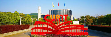
Wenchang Campus: The primary and historic campus in Xuzhou.
Nanhu Campus: Another modern campus in Xuzhou, known for its efficient layout and complete infrastructure.
In Beijing (CUMT-Beijing):
Xueyuan Road Campus: Located in Haidian District, a hub for higher education in Beijing.
Shahe Campus: Situated in the Shahe Higher Education Zone in Changping District.